Outback Rover helps sharpen satellite signals
 Follow
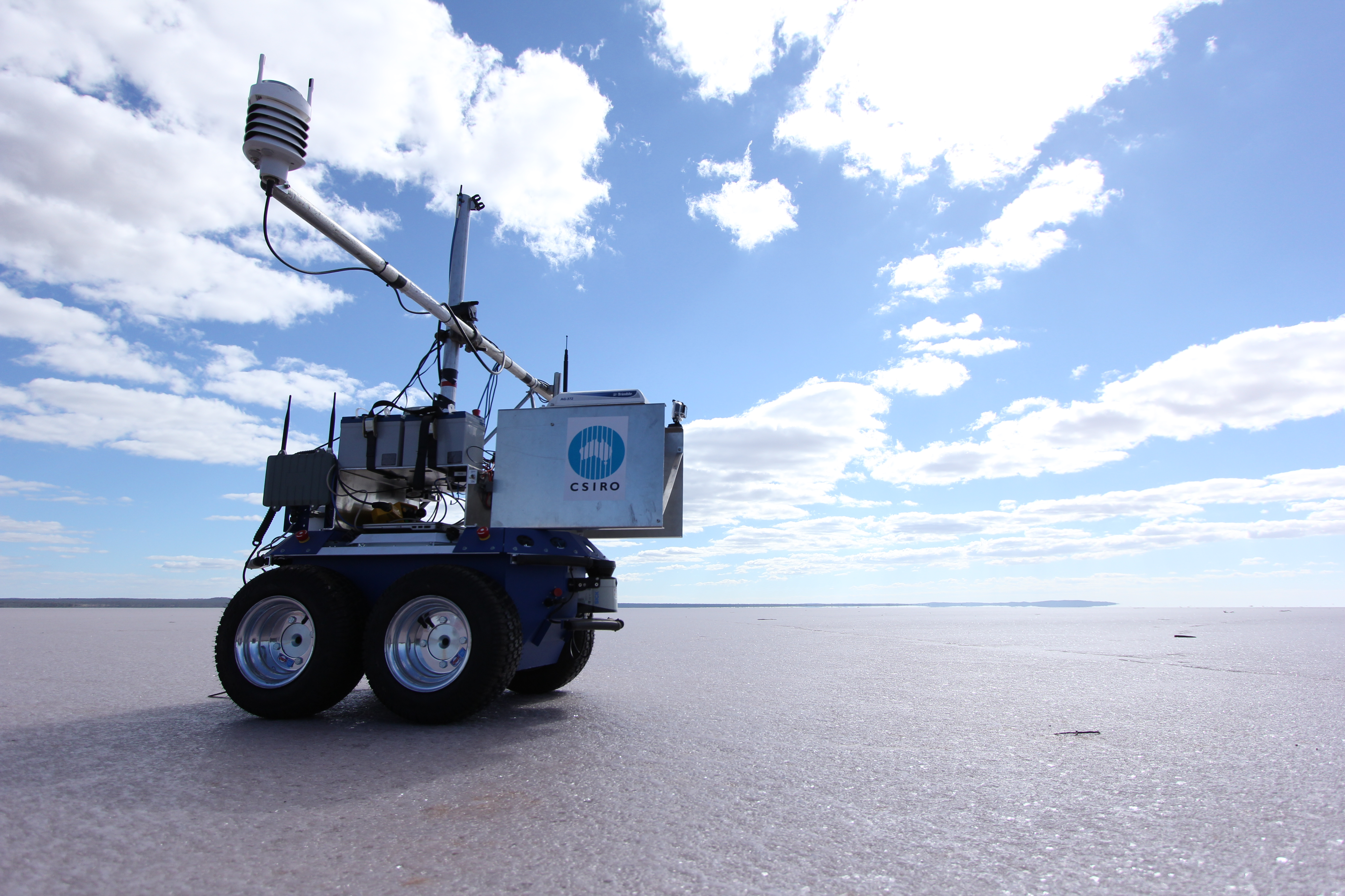
A prototype autonomous vehicle, or rover, developed by CSIRO is helping scientists improve the accuracy of Earth observation satellites that provide valuable data to our mining and agricultural industries.
Just as the Mars Rover Curiosity is gathering information about our neighbouring planet, CSIRO’s affectionately nicknamed ‘Outback Rover’ is helping to calibrate satellites that provide clues to Earth’s soil condition, mineralogy and vegetation.
Accompanied by researchers from Japan, China, Israel and France, CSIRO scientists recently took the rover prototype on a mission to Lake Lefroy – a huge salt lake in remote Western Australia – to see if they can automate the satellite calibration process.
Professor Arnold Dekker, Director of Earth Observation and Informatics at CSIRO, explains that this is where information gathered by satellites is matched against measurements taken on-ground and compared for accuracy.
“Satellite data is used for resource exploration, environmental monitoring and agricultural management such as soil mapping. So it must be regularly cross-checked to ensure that observations are accurate.
“This process is called vicarious calibration and is undertaken by ground crews who walk in grids or transects, taking measurements with hand-held devices known as spectrometers as satellites travel overhead,