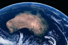
From December 19th last year, Chris Hadfield has been living aboard the International Space Station (ISS) in orbit roughly 400 km above planet Earth. Seeing 15 sunrises every day as the station tracks its way above our planet, the ISS, to quote Hadfield himself, “weighs 500 tonnes and is the size of 5 NHL hockey rinks, with living quarters for 6 people.”
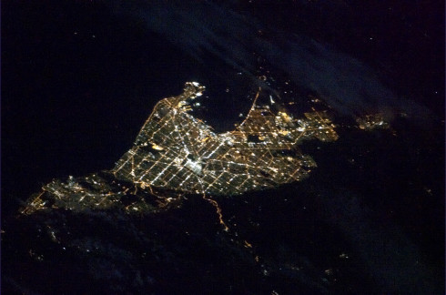
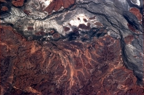
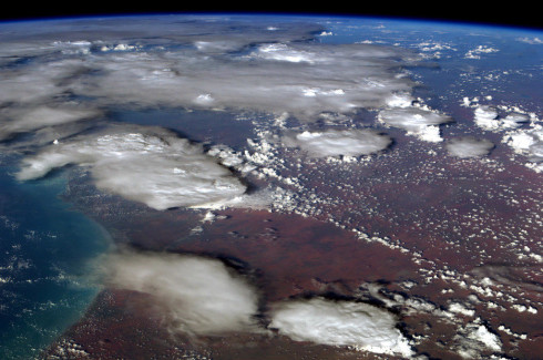
One of the many things which Hadfield has been doing is to keep the tradition set by previous astronauts of taking fantastic photographs of our planet from above. In a Reddit AMA session a couple of months ago, he mentioned that Australia “looks the coolest” from orbit, being fond of the textures and colours of the Australian Outback. So here, for your visual pleasure, are some of the most beautiful pictures of Australia taken from high, high above by Chris Hadfield. Enjoy!
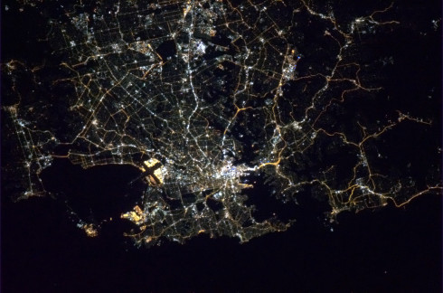
Adelaide by night, glittering like a jewel.
“The Outback is full of scary faces, staring up in forbidding horror.”
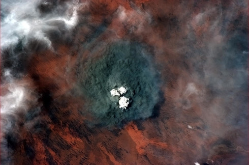
Smoke clouds from the bush fires, as seen from above.
Coffin Bay national park.
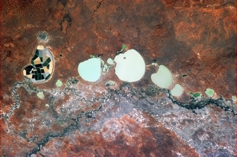
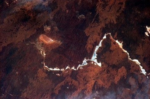
Dry lakes in the Outback, including one which is being used for farming. Quite ingenious.
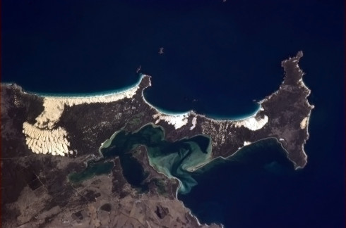
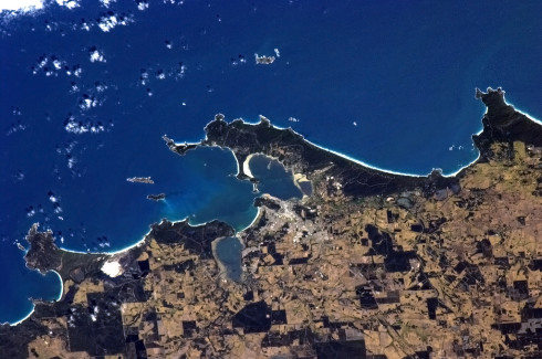
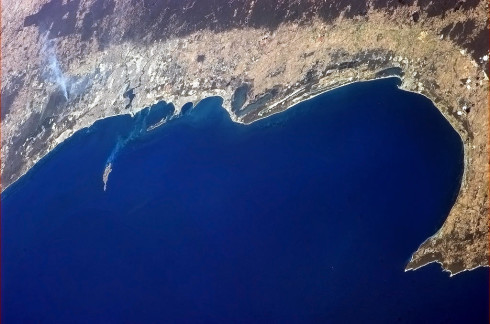
King George’s Sound. Hadfield notes that “Charles Darwin got off the Beagle and hosted a dance here in February, 1836.”
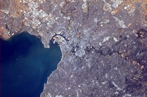
Melbourne harbour.
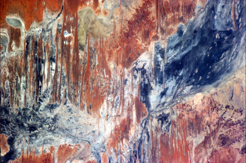
Beautiful smeared colours of a dry lake bed.
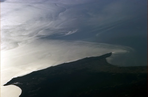
The ocean off the coast of Perth. Evening sunlight catches the waves and ocean currents, making them visible.
Jagged lines of the Outback.
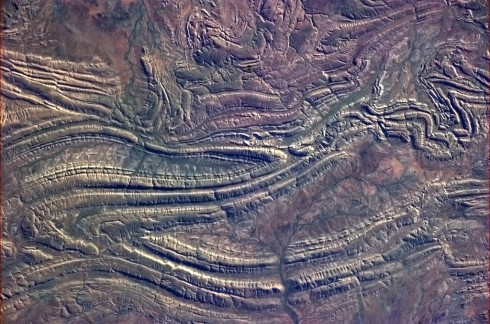
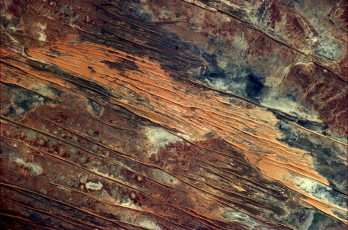
Folded rock formations created by tectonic activity in the Outback. Caught by the morning sunlight, they really stand out.
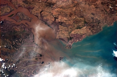
A river delta, showing a host of gorgeous colours.
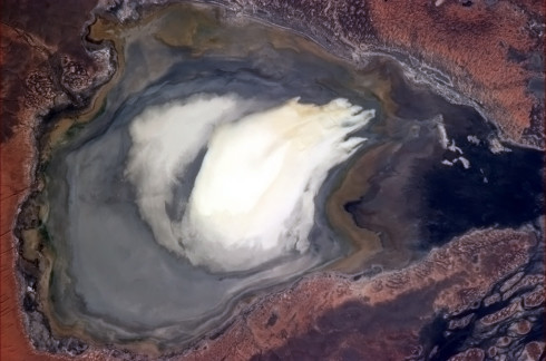
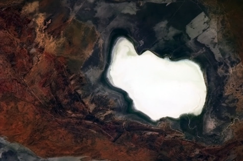
A big dry lake somewhere in the Outback.
Beautiful blue seas off the Perth coast.
“A lot of the Australian Outback looks like somebody spilled something on it.”
The city lights of Sydney.
An ominous looking smoke cloud in Western Australia.
A shot of the Outback looking very much like a Jackson Pollock painting.
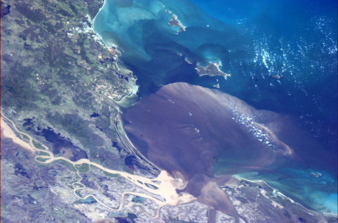
Floodwaters pouring into the Coral Sea near Rockhampton. You can see all the murky brown silt from the river as it disperses into the tides.
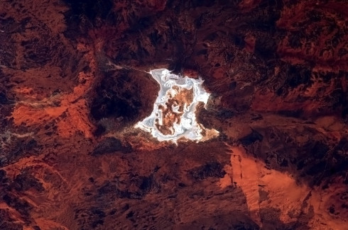
“A splash of dry salt white on seared red in Australia’s agonizingly beautiful Outback.”
Australian researchers are using a novel mobile laser 3D mapping system called Zebedee to preserve some of the country’s oldest and most culturally significant heritage sites.
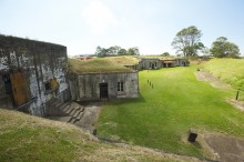
The new joint research initiative between CSIRO and The University of Queensland aims to collect detailed 3D maps of historic sites of Moreton Bay. With the assistance of Queensland Parks and Wildlife Services, the research team have collected data from a number of heritage sites including the 19th century Brisbane River defences at Fort Lytton and Peel Island’s leper colony buildings.
At the core of the technology, developed by CSIRO’s Autonomous Systems Lab in Brisbane, is a laser scanner that swings back and forth on a spring to capture millions of detailed measurements. Zebedee gives researchers the ability to reliably map an environment in 3D by simply walking through it.
“This technology is ideal for cultural heritage mapping, which is usually very time consuming and labour intensive. It can often take a whole research team a number weeks or even months to map a site with the accuracy and detail of what we can produce in a few hours,” said Dr Jonathan Roberts, Director of CSIRO’s Autonomous Systems Lab.
“Zebedee has allowed us to capture a detailed record of several key cultural heritage sites ranging from those which are fragile and risk of damage through natural disasters to those which are remote and difficult to get to,” said Professor John Macarthur, Dean and Head of the School of Architecture at The University of Queensland.
“We’re looking to use these maps in the future to create an archive of rich data about cultural heritage sites, which will allow us to analyse them without costly and time consuming hand measuring. From this, we have already analysed important aspects of Australian history. For example, the detailed map of Peel Island’s many small buildings allowed us to analyse architecture used to racially segregate people within the leper colony. The point cloud data clearly depicts how cramped and crowded the living quarters for Indigenous people were, when compared to the non-Indigenous people who lived in their own huts with scenic verandas,” he said.
The research will be officially launched by the Honourable Andrew Powell, Queensland’s Minster for Environmental Protection and Heritage during an event to mark the beginning of Australia’s National Heritage Week celebrations at Fort Lytton today.
About Zebedee
Zebedee is a handheld 3D mapping system developed by CSIRO that can scan an environment as an operator walks through it. The system produces a 3D map of the environment as well as an accurate record of the trajectory followed. The primary sensing technology utilised is LiDAR (Light Detection and Ranging), in which an infrared laser measures ranges to surfaces in the environment.
The distinguishing feature of Zebedee’s design is that the laser scanner is mounted on a spring, which provides a lightweight solution for ensuring a wide scanning field of view. The spring converts the natural motions of the operator into a suitable sweeping motion of the scanner. A low-cost inertial sensor provides rough measurements of the spring’s rotations. Specially designed software is able to convert the raw range and inertial measurements into a 3D map, represented as a pointcloud, which consists of millions of points expressed in a common coordinate frame.
About CSIRO
CSIRO is Australia’s national science agency and has been pushing the edge of what’s possible for more than 85 years. Today, the organisation has close to 6,500 people working out of 58 centres in Australia and internationally. These people work closely with industry and communities to leave a lasting legacy across five broad areas: food, health and life science industries; energy; environment; information and communications; and manufacturing, materials and minerals.
About National Heritage Week
During Australian Heritage Week, the commonwealth, state and local governments and all National Trust organisations throughout Australia, host community events to present a coordinated and cohesive approach to the importance of our heritage. For more information please visit Australian Heritage Week.
The thing I love the most about scientific discovery is that anyone can do it. Literally anyone could, tomorrow, turn over a stone or look at a seemingly empty spot in the night sky and find something which no human being has ever seen before. Or, perhaps more importantly, something which no one has full appreciated before.
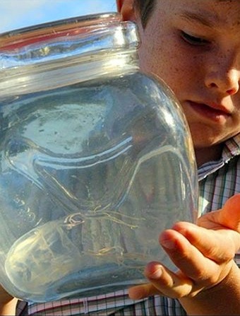
And that’s exactly what happened to nine-year-old Saxon Thomas from Paradise Point in Queensland, Australia. While fishing in a canal in his backyard, Saxon found a jellyfish which he recognised as a box jellyfish. This was surprising at first, because no box jellies had previously been found in these waters. With a little help from his father, he carefully collected the fragile animal into a jar and sent it to Merrick Ekins, a marine expert at the Queensland Museum, to be identified.
But Ekins couldn’t identify it. It’s now been confirmed to actually be a new species, previously unknown to marine biologists. This has caused some consternation among locals who may now be thinking twice about swimming off the nearby coast. A few box jellyfish species are notorious for having extremely painful, and in some cases potentially fatal, stings.
Mercifully, this species is not the box jellyfish, otherwise known as chironex fleckeri, known for its lethal stings. This was the first species which Ekins checked, because if c. fleckeri was found around the coast of Queensland, it would be a big problem for local swimmers. Reassuringly, while the new jellyfish is a related species, it’s definitely not the same one.
Unfortunately though, for now at least, no one’s quite sure whether this new species is dangerous or not. Lacking the resources to investigate it further, local marine biologists explain that they won’t know how severe the stings this jelly can give are until someone is stung by one. Needless to say, no one’s particularly keen to find out voluntarily. While it’s very definitely capable of giving you a sting – this is, after all, how jellyfish catch their prey – it’s probably not life threatening. That said, Ekins cautions that there’s simply no way of knowing this for sure. Swimmers would be well advised to steer clear of them in any case.
Dangerous or otherwise, a new species is always an exciting find for biologists. Lisa Gershwin, director of Australian Marine Stinger Advisory services, shares in the excitement, while wondering what the new jellyfish species should be named. “I haven’t met Saxon yet but my intention is to one of these days when I meet him ask him what he would like it to be named,” she said, in keeping with the tradition that new species are named by whoever discovers it.
However, while this privilege is normally taken by the first scientist to describe the species, Gershwin thinks that Saxon Thomas should have the honour of naming the jellyfish he discovered. She explains, “I wanna give him the choice to name it because I think it’s such a wonderful thing that here’s these kids out playing with nature and going ‘hey wait, that’s different – what’s that?’ – and now we know. What a fabulous find.”
Fabulous indeed. And a reminder that it’s impossible to know when and where discoveries like this will be made next – or who might be there to make them!
Images:
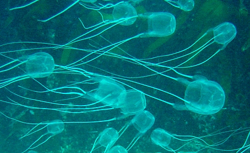
Top – Box jellyfish – Peter Southwood/Wikimedia Commons Bottom – Saxon Thomas with the jellyfish he found – via ABC Gold Coast
Ever gazed out over the sea and wondered what creatures great and small lie beneath? Wouldn’t it be great if the water was so transparent you could see all that swam by?
The Australian fish world was abuzz this week with the release of FishMap, an online mapping tool that allows humans to check out where their favourite marine fish are living these days. You can see what fish are living in your area and what depth they tend to hang out at, just in case you wanted to drop by. The tool gives fish around Australia an unprecedented ability to compete for the attentions of people. With 4500 Australian marine fishes listed, including our 320 sharks and rays, there are sure to be plenty jostling for your affection.
With FishMap you can find out what fish occur at any location or depth in the waters of Australia’s continental shelf and slope. You can also create species lists for any region that include photographs and illustrations, distribution maps and current scientific and common names.
According to the Australian Bureau of Statistics more than five million Australians take part in recreational fishing in Australia as a leisure activity.
There is also a large commercial seafood and aquaculture industry which is worth over $2 billion annually and employs around 16,000 people.
Combined with the number of people who love a good feed of fish, there are a lot of people with a direct interest in the oceans and seas of Australia and what is in them.
Measuring the impact of Australian migration on the Australian carbon footprint is a difficult task because of the complexity of the factors involved. However, a direct cause and effect relationship between the two exists, and it is related partially to population growth due to overseas migration, as well as to rural-urban migrations. Both of which are the consequence of the modernisation and urbanisation of Australian society. This article will present data and research findings about some of the factors that need to be taken into account when discussing the issue of the Australian greenhouse gas emissions. In conclusion it will also share some insights into some of the ways in which the Australian carbon footprint can be reduced.
Rural-Urban Migration
Australia is increasingly becoming an urbanised nation and the scope of migrations from rural to urban areas has recently been growing. A typically higher standard of living in urban areas, industrial development, the built environment and technological advancement; all have a considerable impact on the environment. With urbanisation, the consumption pattern in Australia is changing, and there is a significant increase in consumption per capita.
Recently, there has been more research on how population growth and internal migration into urban areas affect the environment. Australian households are directly responsible for about 20 percent of total carbon pollution. The increasing production of consumer goods has a major impact on the environment – there is an increase of carbon dioxide emissions, or greenhouse gas (GHG) emissions, which is considered the main cause of global warming. Consumption per capita is greater in urban than in rural areas. Greater volumes of transport and removals also have their share in the increase of the carbon footprint. The increase in waste streams resulting from greater consumption causes an amplification of emissions from landfill facilities, which currently emit about 15 million tonnes of carbon pollution per year.[1]
One of the ways to analyse household greenhouse gas expenditure is to break down how much energy consumption and greenhouse gas emissions a human being requires for different needs and aspects of living (such as food or mobility). According to Dr Manfred Lenzen, Professor of Sustainability Research at Integrated Sustainability Analysis (ISA) at the University of Sydney, the analysis of energy and greenhouse gas requirements of different stages in the economy is a better way to structure the data which needs to be considered when creating policies related to the reduction of the carbon footprint.[2]
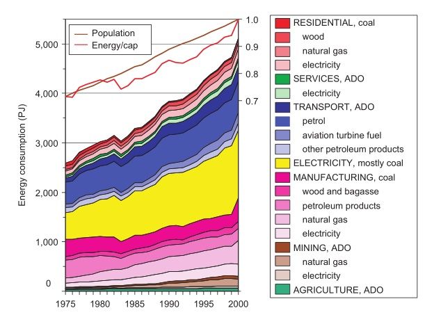
Energy consumption in Australia 1975–2000 (Australian Bureau of Agricultural and Resource Economics 2006)*
Professor Lenzen explained to us that the main advantage of the input-output method is that it includes a complete picture of a household’s GHG responsibility. In some information material from Professor Lenzen’s studies we see that the focus is on switching lights off, having shorter showers, or driving less. But what about our shopping habits? How much emissions were caused because of that T-shirt I just bought, or that flat-screen TV, or that surfboard, or that movie ticket, or that insurance policy? Such things are actually two thirds of the story and must not be ignored. Because if they were, policy would not be as effective as it could be. When it comes to the difference between the consumption-related carbon emissions of households in urban and in rural areas, people in the inner city drive less, so they have some advantages there. However people in rural households usually earn, and therefore spend less, which ultimately is a stronger effect, and therefore rural households cause (generally speaking) less GHG emissions.[3]
The increased need for residential space is another large contributor to carbon pollution through the construction industry and the disposal of demolition waste. Investments into energy efficient homes and appliances provide a partial solution to this problem. According to Professor Dr Deo Prasad, Director of the UNSW Centre for a Sustainable Built Environment, most of the potential low cost greenhouse gas emissions saving opportunities are known to be in the built environment – anywhere between 40-70%, depending on which report and boundary conditions they relate to. However, past experience suggests that market failure/barriers will prevent uptake of these opportunities, even with a price on carbon. In December last year Professor Prasad was one of the experts who launched the Low Carbon Living CRC, which brings together key property, planning, engineering and policy organisations with leading Australian researchers. Their focus was to develop new social, technological and policy tools for reducing greenhouse gas emissions in the built environment. The CRC will help unlock barriers to cost-effective carbon reduction opportunities, empower communities and facilitate the widespread adoption of integrated renewable energy. This will enable the sector to transition and contribute to Australia’s greenhouse gas emissions targets while maintaining industry competitiveness and improving quality of life.[4]
If we look at overall CO2 emissions of countries, according to the 2012 report on trends in global CO2 emissions by the PBL Netherlands Environmental Assessment Agency, Australia is the 16th biggest polluter in the world. However, if we look at CO2 emissions per capita, Australia has earned the unflattering title of the biggest polluter on the planet in 2009, when it replaced the U.S. in the first position with 18.3 tonnes of CO2 emissions per capita. In 2011, while the U.S. CO2 emission levels per capita decreased by 2 percent; Australia’s emissions rose by 3 percent.
Dr David Stern, Professor at the Australian National University and research associate at the Centre for Climate Economics and Policy, discusses his research findings; taking into account the differences between Australia and other countries in terms of the climate, and the type of industries we have – for example, we need less heating but the mining industry is very energy intensive – and other factors, Australia is relatively energy inefficient compared to other developed countries and progress on improving energy efficiency has been quite slow.[5]
There is probably a lot of scope for improving energy efficiency on the consumer side of the economy – energy efficiency of houses, water heating etc. The rebound effect where savings in energy costs are used to spend on other energy using goods and services is more limited for consumers than for industry, and so the gains could be substantial without a lot of take back. Of course, reduced energy use reduces carbon emissions. The Australian government’s carbon price will probably have some effect on this but better information, building codes etc. can help. We have the Energy Efficiency Rating (EER) system for houses for example, but do people know what it means?[6]
Professor Stern also points out that the biggest impact of immigration is going to be that immigrants are generally coming from countries with lower carbon emissions per capita than Australia. The fraction of immigrants coming from the US, Canada, Qatar etc. is small, though there are some. So, when immigrants move to Australia they will increase their emissions on average and that will increase global emissions.
Even though population growth is often quoted as one of the main reasons for the increase in Australia’s CO2 emissions, Australian society and economy are continually evolving and new technologies which contribute to sustainability are being developed on a constant basis. Therefore it is difficult if not impossible to calculate the optimal urban population growth of Australia. Greater sustainability can be achieved mainly through the regulation of urban development and consumption patterns in urban areas – these are the two factors that the government can easily influence both through direct and indirect measures. Urban planning additionally decreases the average commuting time, which is also a significant polluting factor.
Overseas Migration
More than one-fifth, i.e. 23 percent of Australians were born overseas. The majority of immigrants choose to settle in major cities – according to the 2006 Census, 82 percent of overseas-born Australian residents live in major urban areas. In comparison, only 61 percent of Australia-born citizens live in urban areas.[7] Since most migrants move into urban areas, they tend to adopt average urban Australian consumption patterns.
Net overseas migration (NOM) is the difference between the number of people leaving Australia and arriving to Australia in the long term. The influence of NOM on greenhouse gas emissions has been researched, and here are some projections of how NOM will influence air pollution in Australia in the future based on research conducted by the Australian Government Department of Immigration and Citizenship summarized in “Long-term physical implications of net overseas migration: Australia in 2050
Established in 2009 with funding support of A$2.3 million from the Government of Western Australia, WAGCOE brought researchers, industry, investors and government agencies together with the shared vision of creating zero-emission geothermal cities.
Representatives from the partner organisations of The University of Western Australia, CSIRO and Curtin University, as well as state government agencies and industry groups gathered at the Australian Resources Research Centre (ARRC) in south Perth today to reflect on WAGCOE’s achievements, and consider the future of geothermal energy in Australia.
WAGCOE Director Professor Klaus Regenauer-Lieb said the centre had strived to underpin a new era of energy development by developing local solutions.
“At WAGCOE we provided a world-class research and training environment where scientists developed local solutions to revolutionise energy development in Western Australia and contribute to the goal of powering zero-emission geothermal cities.”
Professor Klaus Regenauer-Lieb, WAGCOE Director
“When we consider the challenges of climate change and the need to develop reliable sources of renewable energy, the work of WAGCOE is less about the last four years, than the next 50 years,” Professor Regenauer-Lieb said.
“At WAGCOE we provided a world-class research and training environment where scientists developed local solutions to revolutionise energy development in Western Australia and contribute to the goal of powering zero-emission geothermal cities.”
Internationally, the work of WAGCOE led to the Geothermal Energy Association (GEA) identifying Perth as one of the top ten (number five) “Geothermal Cities” of the world. Unlike other entries to the list, however, Perth’s inclusion was unique as it was earned on the merit of plans to become the world’s first geothermally-cooled city.
Among WAGCOE’s other major achievements was the development of a 3-D computer model illustrating a comprehensive geological assessment of the entire Perth Basin, which will act as a template for future geothermal activities in the region.
The centre was also instrumental in securing A$20 million of Australian Government funding for the CSIRO Geothermal Project, which will aim to prove the viability of using geothermal energy on a large-scale by cooling the Pawsey Centre Supercomputer located at the ARRC facility in south Perth.
A successful CSIRO Geothermal project will provide enormous benefits to the geothermal industry, and make significant progress in establishing Perth as the world’s first geothermally-cooled city.
For further information about geothermal research and activities post-WAGCOE, please contact Professor Klaus Regenauer-Lieb on +61 8 6436 8693, or Klaus.Regenauer-Lieb@csiro.au
Source and image: WAGCOE Director Professor Klaus Regenauer-Lieb discusses the CSIRO Geothermal Project with project officer Jacqui Cook, at the ARRC site in Perth.
Following three years of research and planning, CSIRO and the Terrestrial Ecosystem Research Network (TERN) have opened Australia’s first large-scale rainforest research plot.
The plot, which is located at Robson Creek on the Atherton Tablelands near Cairns, will allow scientists to monitor the rainforest over the long term and answer questions about the health of this unique Australian environment and any impacts that might arise from climate change.
‘In preparing the plot for research, we established baseline data by identifying, mapping and measuring every tree that was greater than 10cm in diameter so we can continue to monitor them. We censused over 23 000 stems from 212 different species and there is estimated to be more than 400 plant species represented on the plot,’ said Matt Bradford, a field botanist who manages the Robson Creek site for the CSIRO.
‘It’s been a huge effort, but it’s a great place to be working. There’s such a diversity of life and some of the trees on site are well over a thousand years old.’
TERN and CSIRO are now inviting scientists from Australia and across the world to undertake research at the Robson Creek site, which is the largest rainforest plot that has ever been set up in Australia.
‘Already there are studies under way involving CSIRO and four Australian universities looking at the diversity of plants, birds, animals and insects and the dynamics of how things like water, carbon and gases move through the ecosystem,’ said Mr Bradford.
‘A state of the art flux measuring tower, part of TERN’s OzFlux network, will be installed on the site in coming months that will monitor gas exchange between the forest and the atmosphere, allowing us to observe how climate change might affect this ecosystem.’
The Robson Creek plot forms part of the Far North Queensland Rainforest Supersite, which carries out research on the rainforests of the World Heritage Wet Tropics region. The Rainforest Supersite is one of ten research ‘Supersites’ that make up the Australian Supersite Network established by TERN. These Supersites are enabling long-term monitoring of key Australian ecosystems and provide a unique opportunity for scientists to answer questions about species distribution, the potential for carbon storage and exchange, and the impacts of a changing climate.
‘We envisage that the Robson Creek plot will quickly become an important part of the global forest plot network that will allow for comparisons with other tropical forests and contribute to our understanding of how the world’s forests will adapt to any effects of climate change.’
Mr Bradford and other scientists will be speaking about the Supersites at the 2013 TERN Annual Symposium taking place this week in Canberra. For more information about the Symposium visit www.tern.org.au/Welcome-pg24024.html.
TERN is supported by the Australian Government through the National Collaborative Research Infrastructure Strategy and the Super Science Initiative.
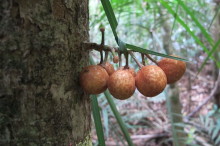
Source and image: A Yellow Mahogany tree (Dysoxylum parasiticum) on the rainforest Supersite showing the unusual trait of bearing fruit on the stem.
Dr Manuel J Blanco joins CSIRO as Director of the Australian Solar Thermal Research Initiative (ASTRI).
ASTRI is an A$87 million, eight year international collaboration transforming the energy industry in Australia by bringing down the cost of solar thermal, a unique energy technology that can create electricity, heat and fuels.
“Australia has one of the best solar resources in the world. It is a natural fit for an international solar thermal research collaboration to use this resource and our expertise to make solar power the cheapest, cleanest energy source it can be.”
Dr Manuel J Blanco, Director – Australian Solar Thermal Research Initiative
Dr Blanco, a world-renowned solar scientist with almost three decades of academic, research and development managerial experience, comes to ASTRI from Spain’s National Renewable Energy Centre (CENER), where he was Director of the Solar Thermal Energy Department.
Dr Blanco has made an invaluable contribution to the international solar thermal industry, including paving the way for the first commercial solar thermal system installed in Spain and chairing the International Energy Agency’s SolarPACES executive committee, the 20-country network for solar thermal collaboration.
“Australia has one of the best solar resources in the world. It is a natural fit for an international solar thermal research collaboration to use this resource and our expertise to make solar power the cheapest, cleanest energy source it can be.
“We will reduce the cost of solar thermal to just 12 cents a kilowatt hour by 2020 and provide zero-emission energy to people when they need it. It’s a technological leap but we will do it. We are working with the best in the world,
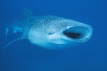
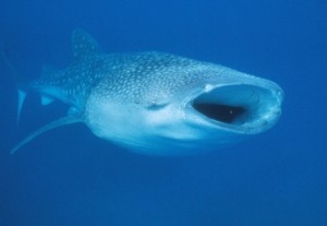
It has been a big year for ECOCEAN’s whale shark whale shark photo identification library. There have been a record of 256 whale shark sightings at Western Australia’s most recently listed World Heritage site, Ningaloo.
This has been due to more people signing up as citizen scientists to contribute to ECOCEAN’s whale shake monitoring program. When more people collect data, more sharks can be identified.
Of the 256 identified whale sharks identified, 107 were new and 149 were whale sharks that had been seen in the Ningaloo Marine Park before.
“We couldn’t have achieved these results without the generosity of the WA community
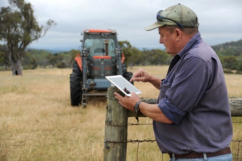
Australia’s national soil databases can now be accessed in real time online through a new iPad app called SoilMapp.
The new app provides open access to the best and most up-to-date information for soil at any location in the country within a matter of seconds.
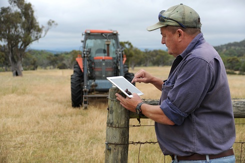
The SoilMapp for iPad will allow farmers and others to access real time information about their soils from in the field.
Information such as soil depth, acidity, salinity, soil carbon, soil water holding capacity and other attributes will help land managers, farmers and rural advisors make on-the-spot, decisions about how to more effectively manage their land.
This mobile device technology will deliver detailed scientific information on soils directly into the hands of farmers, rural consultants, agronomists, and potentially other soil enthusiasts like real estate agents, hobby farmers and keen bushwalkers.
The app has been developed by the Australian Collaborative Land Evaluation Program (ACLEP) and CSIRO, with funding from the Grains Research and Development Corporation (GRDC), because understanding soils is essential for sustaining healthy, natural environments and productive agricultural landscapes.
CSIRO’s Mike Grundy said soils are one of the most important building blocks of our agricultural and ecological systems and are a precious natural asset.
“They sustain food production, biodiversity, water quality and play a key role in human health. Understanding the characteristics of soil allows us to ensure we make decisions about its management to ensure maximum productivity and maintain or improve its health for today and future generations,” Mr Grundy said.
SoilMapp is the first app developed by CSIRO and it is being launched at the Joint Australian and New Zealand Soil Science Conference in Hobart on Tuesday, in time for World Soil Day on Wednesday. The app taps into soil information from the Australian Soil Resource Information System (ASRIS) and APSoil, the database behind the farming systems model, the Agricultural Production Systems SIMulator (APSIM), which is used worldwide.
Both these databases are stocked with contributions from thousands of individuals and organisations including the Australian Government Department of Agriculture, Fisheries and Forestry (DAFF), state and territory agencies responsible for land resource assessment, Geoscience Australia, and soil research and industry groups. The databases contain information about approximately 85,000 samples from nearly 15,000 locations, some dating back to the 1950s.
“There’s a lot of information about Australian soils stored in these two databases and the beautiful thing about SoilMapp is that it provides a user friendly mechanism for accessing that information in real time, on location,” Mr Grundy said.
“Although that information is already available through the web, it is now of far more use to famers or consultants working out on the land because it can be at your fingertips in the field, and at no cost. Importantly, as our soil agencies improve their data collections, SoilMapp will provide access to later releases,” he said.
Senior Agronomist Steve Richmond from Kerin Landmark Rural said the app will be a welcome addition to his decision making toolkit when speaking with growers.
“By understanding the soil’s characterisation, water holding capacity and amount of organic carbon, we can make calculations about how much nitrogen to use on certain crops. This could lead to improvements in fertiliser use efficiency as well helping prevent soil acidification from the overuse of nitrogen. That provides a productivity benefit as well as environmental and economic benefits,” Mr Richmond said.
“Farmers are the custodians of vast tracts of Australia, and the decisions they make daily will impact on the short and long term future of this country’s ability to feed itself, meet growing global demands and to sustain its natural beauty. The more informed we can be when making these decisions, the greater benefit we can deliver for both productivity and environmental health. It’s a win-win,” he said.
While SoilMapp for iPad currently accesses Australian information, other users may soon be able to get the benefit of this technology, with CSIRO exploring the possibility of working with partners in New Zealand, Indonesia and the Pacific Island countries to widen the scope of SoilMapp.
SoilMapp was developed by CSIRO through the Australian Collaborative Land Evaluation Program (ACLEP) and the Grains Research and Development Corporation (GRDC) project Doing it better, doing it smarter — managing soil water in Australian agriculture.
SoilMapp for iPad will be available from the App Store soon.
Media are invited to attend the Joint Australian and New Zealand Soil Science Conference on Monday and Tuesday to use SoilMapp and speak with the researchers that developed it.
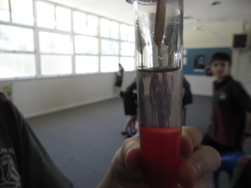
Hands on science activities to engage students in scientific inquiry and investigation are key in the early years to develop skills and knowledge in all areas of science. No one knows this better than Mrs Suzanne Clarke who is the founder of the mini-scammers science club at Mitchelton State School, a feeder club for SC@M (Science Club at Mitchie).
Hands on learning in the early years.
Established just this year, the junior science club encourages students in the early years to formulate hypothesis, carry out experiments and discuss their findings with their peers directly mirroring the similar process used in later years. Student work in multi-aged groups to manipulate materials and equipment, generate solutions and compare their results. As Mrs Clarke highlights “this method of discovery learning engages all children and promotes the use of multiple intelligences
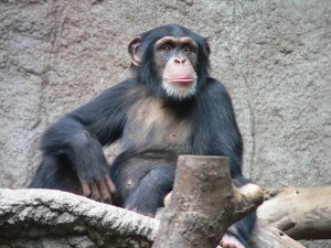
The midlife crisis is more complicated than first thought. It might be time to stop blaming troubled marriages and feeling obsolete in a sea of younger colleagues. A study published in the Proceedings of the Natural Academy of Sciences has revealed that chimpanzees and orangutans also experience a midlife crisis.
Having a midlife crisis may not just be the result of a troubled marriage or the thought that life may be halfway over. It might be part of primate biology. That’s right, hardwired into us.
“Maybe discontent lights a fire under people, causing them to achieve more for themselves and their family.”
A shiny new red sports car might just indeed lead to better things.
Danielle Spencer runs a science club at Mitchelton State School in Queensland and explored where gender stereotypes in science began. Where does the perception that men do the “hard” sciences and women do the “soft” sciences come from? A group of 45 primary school students were surveyed and it was found that a majority of students thought that science was accessible to both genders.
When asked why there are more men than women in engineering roles, the students responded with gender based answers like “Girls like dancing and other jobs.” and “Women are more suited to caring and developing jobs like childcare and nursing.”. There was no response that challenging this observation. This was despite 75% of the group thinking that science was accessible to them. It is disheartening to hear.
Students were asked whether their science club should be split into a boys only and girls only science club, there was overwhelming support for a combined science club. There was an appreciation and acknowledgement that irrespective of gender, everyone had a valuable contribution. At the moment this cohort of students believe that science is something that everyone can do. The question remains though, how do we get adults to believe this?
As this week drew to a close, attention focused on NASA’s Jet Propulsion Laboratory in Pasadena, California. A story broke at NPR reporting that the Curiosity Rover may have found some exciting news. Project Scientist at the Mars Science Laboratory, John Grotzinger was quoted to saying:
“We’re getting data from SAM as we sit here and speak, and the data looks really interesting.”
SAM, the Sample Analysis at Mars is a miniaturised chemistry lab. On board is a Gas Chromatograph, Quadrupole Mass Spectrometer, Tunable Laser Spectrometer as well as sample processing systems that allow heating and chemically treating samples. Normally these instruments would fill the space in a laboratory but on Curiosity it’s around the size of a microwave. SAM is being used to collect information about the past and present chemistry of Mars. As well as this SAM is also identifying organic and inorganic chemical molecules known to be important to life on Earth.
So what has SAM found? Nothing has been confirmed but it does sound like there is something especially when Grotzinger says:
“This data is gonna be one for the history books.”
We will have to wait at least several weeks before NASA makes an announcement.
New Zealand’s volcano, Mount Tongariro made it into this week’s news with an eruption on Wednesday. Luckily there have been no reports of damage or injuries. However, a group of travellers and journalists hiking at the time witnessed and filmed the eruption.
Minister for Innovation, Services and Small Business Louise Asher today announced that two world leaders in storm-water management and bioinformatics, Professors Ana Deletic from Monash Water for Liveability and Terence Speed from the Walter and Eliza Hall Institute, have won the 2012 Victoria Prize for Science and Innovation.
Professor Deletic is the first female scientist to be awarded the Prize in its 14 year history.
Speaking at a ceremony to award the winners of the Victoria Prize for Science and Innovation and the Victoria Fellowships, Ms Asher said the Victorian Coalition Government was committed to supporting science and innovation and had awarded two $50,000 Victoria Prizes this year instead of one, as well as increasing the number of $18,000 Victoria Fellowships from six to 12.
“The Coalition Government has invested $1.7 million in Victoria’s innovation researchers since 2011, and has committed to treble this investment over the next three years to $4.8 million,